Abuja Landmass
Abuja is located in the center of Nigeria, within the Federal Capital Territory (FCT). Abuja is a planned city and was built mainly in the 1980s. It officially became Nigeria’s capital on 12 December 1991, replacing Lagos, though the latter remains the country’s most populous city. At the 2006 census, the city of Abuja had a population of 776,298, making it one of the ten most populous cities in Nigeria. This article contains a Brief History of Abuja, local government areas, and their landmass.
Brief History Of Abuja
The land now called Abuja was originally the southwestern part of the ancient Habe Hausa kingdom of Zazzau Zaria. Abuja is the capital and eighth most populous city of Nigeria. Situated in the middle of the country within the Federal Capital Territory FCT, it is a planned city built mainly in the 1980s based on a master plan by International Planning Associates. The Presidential Complex, National Assembly, Supreme Court, and much of the city extend to the south of the rock. Zuma Rock, a 792-metre (2,598 ft) monolith, lies just north of the city on the expressway to Kaduna.
According to an online report Abuja is Nigeria’s administrative and political capital. It is also a key capital on the African continent due to Nigeria’s geo-political influence in regional affairs. Abuja is also a conference center and hosts various meetings annually, such as the 2003 Commonwealth Heads of Government meeting and the 2014 World Economic Forum (Africa) meeting. Abuja joined the UNESCO Global Network of Learning Cities in 2016.
Economically, Real estate is a major driver of the Abuja economy, It correlates with the considerable growth and investment the city has seen as it has developed. The sources of this investment have been both foreign and local and the real estate sector continues to positively impact the city, as it is a major avenue for employment.
Abuja Landmass
The land now called Abuja was originally the southwestern part of the ancient Habe (Hausa) kingdom of Zazzau (Zaria). Abuja is home to several parks and green areas, the largest being Millennium Park. Architect Manfredi Nicoletti designed Millennium Park which was officially opened by the United Kingdom’s Queen Elizabeth II the former Queen of Nigeria in December 2003.
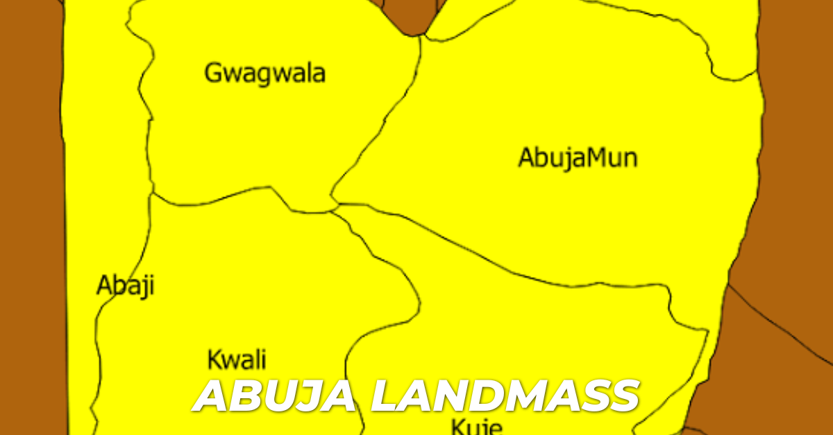
The combined land area of these 6 councils is roughly 7,290 km2 and the local government includes, Abaji, Abuja Municipal Area Council, Bwari, Kuje, Gwagwalada, and Kwali. The tallest building in this district is the Radio House located in the Area 11 sector, which houses the Federal Ministry of Information and Communications, the Federal Radio Corporation Of Nigeria FRCN, and Voice of Nigeria (VON). The Nigerian Television Authority (NTA) stations and corporate headquarters are also in Garki. The Federal Capital Development Authority (FCDA) which oversees and runs the Administration of the Federal Capital Territory has its offices in Garki.
| Local Government Areas | Land mass |
| 1. Abaji | 905 km² |
| 2. Abuja Municipal | 900 km² |
| 3. Bwari | 901 km² |
| 4. Kuje | 902 km² |
| 5. Gwagwalada | 902 km² |
| 6. Kwali | 904 km² |
READ MORE ON LANDMART.NG
- Business Ideas for Entrepreneurs in Lekki
- Is Lekki Phase 1 A Good Place for Entrepreneurs to Build Their Businesses?
- Everything You Need to Know About Lekki Phase 1


