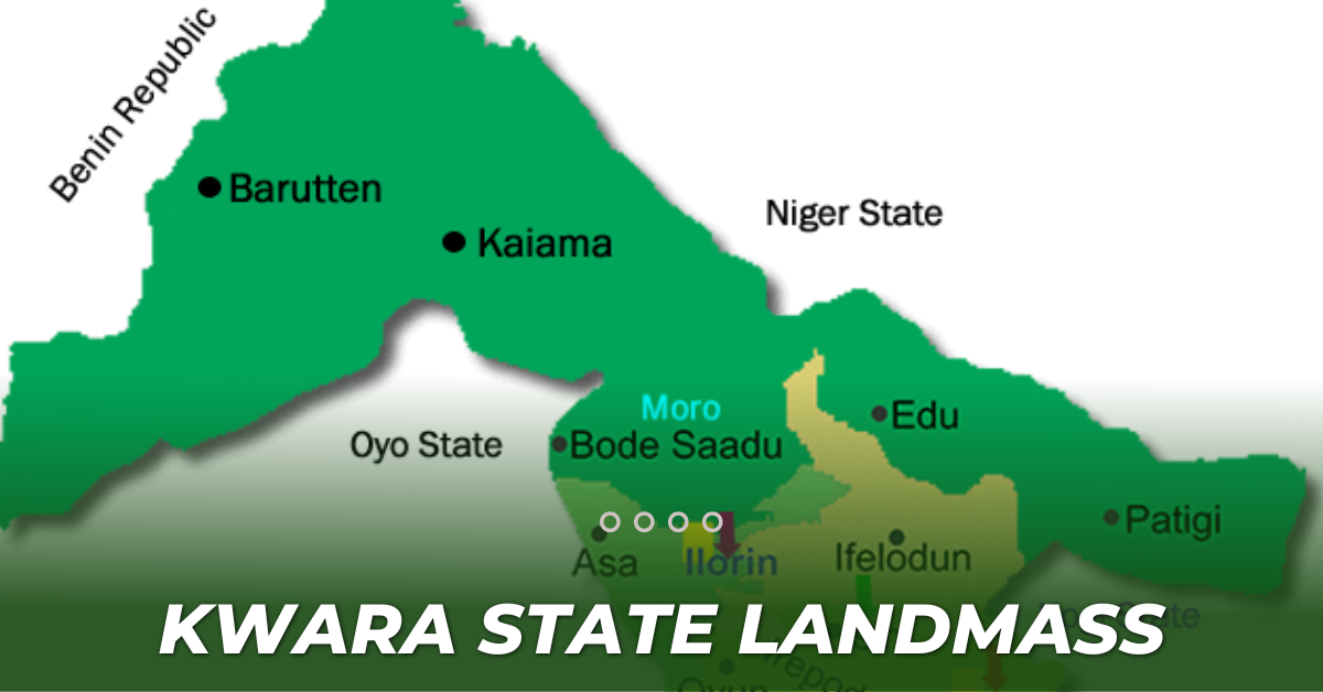
landmass of Kwara State
Kwara State is one of the 36 states of Nigeria with the capital, in Ilorin. Kwara State was created on 27 May 1967, when the Federal Military Government of General Yakubu Gowon broke the four regions that then constituted the Federation of Nigeria into 12 states. Kwara State has since 1976 reduced considerably in size due to further state creation exercises in Nigeria. This article contains detailed information on the landmass of Kwara state and its 16 local governments.
Brief History of Kwara State
Kwara State is a Western state in Nigeria, bordered to the east by Kogi State, to the north by Niger State, and the south by Ekiti, Osun, and Oyo states, while its western border makes up part of the international border with the Benin Republic. Its capital is the city of Ilorin and the state has 16 local government areas. The first Governor of Kwara state was David Bamigboye. The current governor of Kwara State is Governor Abdulrazaq Abdulrahman, who emerged victorious in the March 9, 2019 governorship election, with the political party APC. Abdul Rahman Abdul Razak was sworn in on May 29, 2019, making him the 4th democratic governor of Kwara State and the 20th governor of Kwara State overall.
According to online reports, Kwara is the ninth largest in area, but the sixth least populous, with an estimated population of about 3.2 million as of 2016. Geographically, Kwara State is split between the West Sudanian savanna in the west, and the Guinean forest–savanna mosaic ecoregion in the rest of the states. Important geographic features of the state include rivers, with the Niger flowing along the northern border into Lake Jeba, before continuing as the border, while the Awun, Asa, Aluko, and Oyun rivers flow through the interior.
Economically, Kwara state is largely based on agriculture, mainly coffee, cotton, groundnut, cocoa, oil palm, and kola nut crops. Other key industries are services, especially in the city of Ilorin, and the livestock herding and ranching of cattle, goats, and sheep. Kwara state has the joint-twentieth highest Human Development Index in the country and numerous institutions of tertiary education.
Land Mass
Kwara State was created in May 1967, as one of the first of 12 states to replace the nation’s four regions. Formerly the State was known as West Central State, but the name was changed to Kwara, a local name for the Niger River. The size of the State has been reduced over the years, as new states have been created within the federation The total landmass of Kwara State today is 36,825 km² with its 16 local governments.
Local Government Areas In Kwara State
Kwara state is the ninth largest in the area consisting of Sixteen local governments which includes
- Asa
- Baruten
- Edu
- Ilorin East
- Ilorin West
- Ilorin South
- Ekiti
- Ifelodun
- Irepodun
- Isin
- Kaiama
- Moro
- Offa
- Oke Ero
- Oyun
- Pategi
| No Of Local Government | Area (Km²) |
| 1. Asa | 1,286 |
| 2. Baruten | 9,749 |
| 3. Edu | 2,542 |
| 4. Ilorin East | 486 |
| 5. Ilorin West | 105 |
| 6. Ilorin South | 174 |
| 7. Ekiti | 480 |
| 8. Ifelodun | 3,435 |
| 9. Isin | 633 |
| 10. Kaiama | 6,971 |
| 11. Moro | 3,272 |
| 12. Offa | 95 |
| 13. Oke Ero | 438 |
| 14. Oyun | 476 |
| 15. Pategi | 2,913 |
| 16. Irepodun | 737 |
All these figures are based on online reports.
READ MORE ON LANDMART.NG


